Tuesday, November 9, 2010

Superstitions and endings


I'm not sure that there could have been a better ending to this trip than hiking in the Superstition Wilderness.

Nope.

From GET - Arizona

The Ray Mine Complex is in the background, quite a bit before entering the Supes. I had expected to be revolted when I saw the Morenci Mine weeks earlier. Instead, I was treated with a view that didn't really hint at the full scale of how huge the mine was. Nearing the "town" of Kinsley I saw the Ray mine from above and was sickened. The land around was all red, but from above I was seeing whites and turqoise colors that just should not have been there. HUGE. This photo doesn't hint at the scale of it so much, but it's still quite deep.

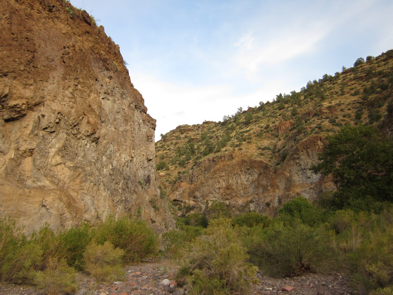
White Canyon Wilderness (surprising rough AZT conditions)turned out to be one of the hidden gems of Arizona. Huge canyons. Really strange strange buttes.

Mother Nature is a strange woman indeed.


By this point I'd fallen completely in love with the Sonoran desert. For what it's worth, this desert felt surprisingly "lush". Saguaros everywhere. Agave. Yucca. Cholla cactus and their "bombs", etc etc etc. The desert (Chihuahuan?) of New Mexico really couldn't compare to this.

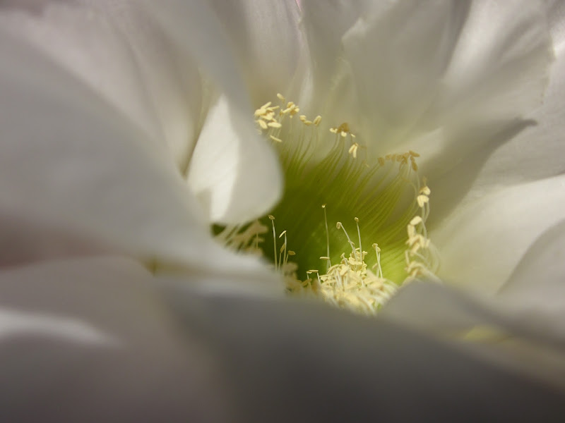
Took a quick sidetrip to the Boyce-Thompson Arboretum in Superior, catching some nice flowering Cardon Saguaro, among many many other desert wonders


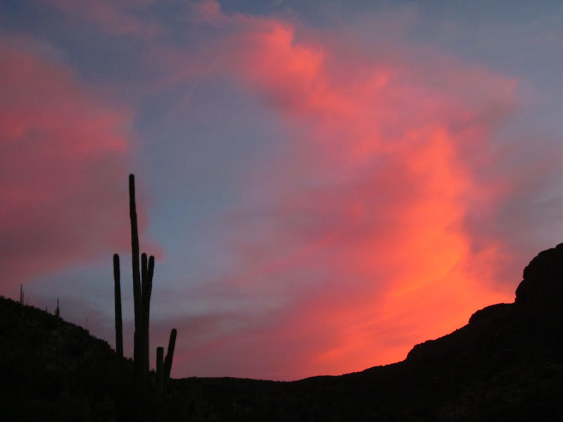
sunsets that linger for an hour never really get old.

did a nice and steep climb to drop back down into Reavis Canyon and the southern end of the Superstitions


huge views. overgrown trail. more huge views.


After taking a nap in the shade at the top of Parker Pass, I was 2 miles from the Trailhead and the end of the hike. 15 minutes later I found myself hiking with Gopher's friend Brian, his girlfriend Katrina, and engulfed in my first conversation WHILE hiking in a month. Before I knew it we were standing in the parking lot and my trip was over. Showered, laundered, and inspired, we drank amazing beers at the Four Peaks Brewery in Tempe, ate salmon BLT's, and I slept inside for the first time in 39 days.

This was probably my favorite thru-hike that I've ever done. The sense of adventure was here that never really existed on the other hikes...well maybe in the Grand Canyon Hayduke route.... Every morning I would wake up, and over a cup of coffee I'd wonder what I'd see that day. Every single day was unique in a way I've never seen before. Maybe I'm getting older and appreciating subtle changes more, but I do believe that this trail really has more variation than others. There are just way too many mountain ranges out here that you do quick traverses of, then drop into a canyon to bottom out on desert floor. Climb around up other canyons or through the grassland hills of NM, and up into a totally unique mountain range 3 days later.

Great adventure, and thanks for following along.

Iconic Weaver's Needle and one of the cooler features of the Wilderness.

Thursday, November 4, 2010

quickly


where'd the trail go???


i've honestly decided to stop eating beef because of these guys

turkey creek dwelling


evil cholla cactus

Saguaro corpse

Monday, October 25, 2010

No...Don't Fall In!!!


Full disclosure: although I hyped the Gila up in the previous post as being incredibly gorgeous (it really was!), it was possibly the most boring part of this hike. That probably says a lot about me as a person, but no need to dive into that here and now. All of the adventure, route-finding, and doubt was gone in the Gila, leaving me following 130ish miles of well-marked trail. Beautiful trails, but I felt like I was on the AT out there. Well, whatever I thought was lacking in the Gila was more than made up for in the 4 days so far in Arizona.

WHERE DID THE TRAIL GO?


After a rough night's sleep in the first developed campground of the trip (potty stench), I left Glenwood at 5:30 under only starlight. Refusing to buy $6 AAAs, I walked 5 miles on the glowing white lines framing the asphalt to get to the Alma diner for an early breakfast and rancher gossip. Huevos Rancheros with green chile got me back on the official route and a 9-mile roadwalk on a sleepy jeep road over Sunflower Mesa.

Here I could see the strange mesas that butt directly against the mountains. Duh, I've seen many a mesa before, but never like these. They stand hundreds of feet off the valley floor, and protrude from a surrounding ridge. awesome.

And then I was welcomed into Arizona....with rocks. The guidebook warns of this, but it's impossible to belive until you actually see and feel it. The very second I walked over that arbitrary and straight Arizona border, the road got at least 10x rockier. How??

And then the trail disappeared. The Charlie Moore Trail is listed on maps, but no one actually gets out into the Blue Range Primitive Area to hike it. When the trail faded into nothingness, I just looked at the map and went where I thought I should be. And there it was!

This kept happening all the way up Maple Peak. The sky had been growing darker all morning, and now at the top it decided to hail on me, then 500 feet lower transformed into rain. The sky cleared up in time for huge views of the Gila and Pinaleno Mtns ahead. Dry in time for a camp on a saddle in the only rocklesss and flat spot around.


I HATE GETTING WET!


You know those rocks I mentioned? On the way uphill they merely hurt a little, on the way down they become marbles. I fell more that morning descent Maple Peak to reach Blue River than I had in the previous 21 days of hiking. And I broke a trekking pole. Cry me a river.

not much internet time, so here go the pics, and no text:


that's highway 666!!!


awesome groves of Mesquite...better hiking than the rocks of Eagle Creek

Eagle Creek competes with some of the best canyons that UT can offer...


awesome camp. Sounds of the creek next to me, and a full moon illuminated them walls


water is life


slot canyon!


Anasize granary if you look close!


fancy trail. ugly sign./


Pinaleno Mtns near Safford