Monday, October 25, 2010

No...Don't Fall In!!!


Full disclosure: although I hyped the Gila up in the previous post as being incredibly gorgeous (it really was!), it was possibly the most boring part of this hike. That probably says a lot about me as a person, but no need to dive into that here and now. All of the adventure, route-finding, and doubt was gone in the Gila, leaving me following 130ish miles of well-marked trail. Beautiful trails, but I felt like I was on the AT out there. Well, whatever I thought was lacking in the Gila was more than made up for in the 4 days so far in Arizona.

WHERE DID THE TRAIL GO?


After a rough night's sleep in the first developed campground of the trip (potty stench), I left Glenwood at 5:30 under only starlight. Refusing to buy $6 AAAs, I walked 5 miles on the glowing white lines framing the asphalt to get to the Alma diner for an early breakfast and rancher gossip. Huevos Rancheros with green chile got me back on the official route and a 9-mile roadwalk on a sleepy jeep road over Sunflower Mesa.

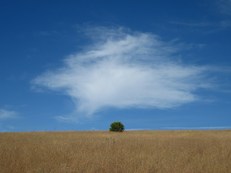
Here I could see the strange mesas that butt directly against the mountains. Duh, I've seen many a mesa before, but never like these. They stand hundreds of feet off the valley floor, and protrude from a surrounding ridge. awesome.

And then I was welcomed into Arizona....with rocks. The guidebook warns of this, but it's impossible to belive until you actually see and feel it. The very second I walked over that arbitrary and straight Arizona border, the road got at least 10x rockier. How??

And then the trail disappeared. The Charlie Moore Trail is listed on maps, but no one actually gets out into the Blue Range Primitive Area to hike it. When the trail faded into nothingness, I just looked at the map and went where I thought I should be. And there it was!

This kept happening all the way up Maple Peak. The sky had been growing darker all morning, and now at the top it decided to hail on me, then 500 feet lower transformed into rain. The sky cleared up in time for huge views of the Gila and Pinaleno Mtns ahead. Dry in time for a camp on a saddle in the only rocklesss and flat spot around.


I HATE GETTING WET!


You know those rocks I mentioned? On the way uphill they merely hurt a little, on the way down they become marbles. I fell more that morning descent Maple Peak to reach Blue River than I had in the previous 21 days of hiking. And I broke a trekking pole. Cry me a river.

not much internet time, so here go the pics, and no text:


that's highway 666!!!


awesome groves of Mesquite...better hiking than the rocks of Eagle Creek

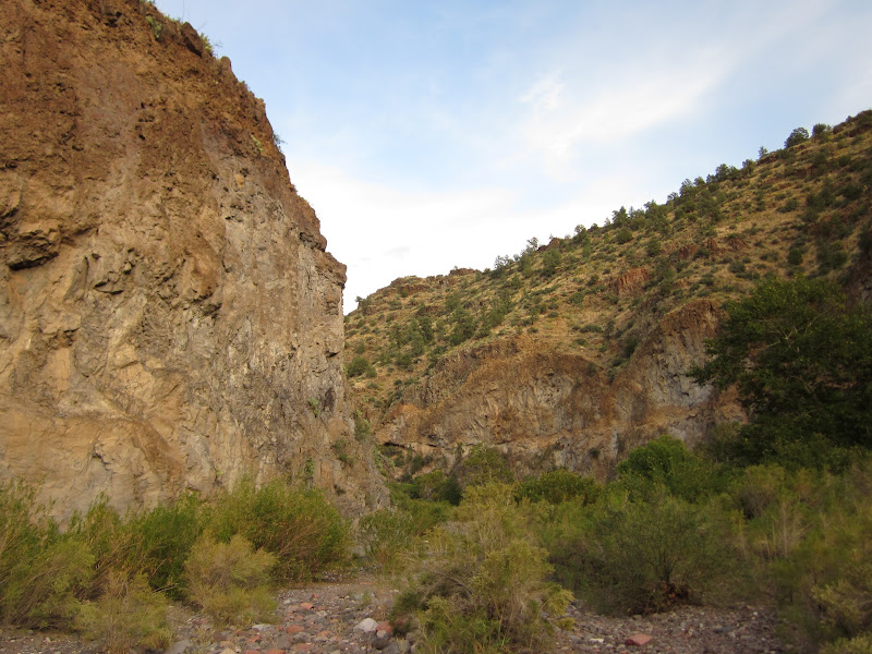
Eagle Creek competes with some of the best canyons that UT can offer...


awesome camp. Sounds of the creek next to me, and a full moon illuminated them walls


water is life


slot canyon!


Anasize granary if you look close!


fancy trail. ugly sign./


Pinaleno Mtns near Safford

Tuesday, October 19, 2010

THE Gila

From GET - Nuevo Mexico

Do you know when Colombus Day is? I definitely had no clue as I found myself walking to the door of the Monticello Post Office to pick up my package of 7 days of food and 40 or so maps. More on that later...

How can I sum up the last 2 weeks of hiking? I don't know how, nor do I have the patience to type it all out. What I do know is that I'm not sure I've ever done such consistently isolated hiking in my life. I mentioned it a bit in the last post, but the "out there" factor just hit a new high in the Gila. In 7 days of hiking from the Eastern Gila (Black Range) to the West (Mogollion Mtns), I saw only 3 people on the trails out there. The GET founder, Blisterfree, and 2 stoned elk-hunters. Unbelievable. And all of this for the first created, and most well-known Wilderness Area's in the country.

Photos and oh-so-brief summaries will have to suffice...

left the town of Magdalena to enter some nice ridgewalking along the Magdelena Mtns.
From GET - Nuevo Mexico


sick sunrise from the top of South Baldy in the Magdalena's
From GET - Nuevo Mexico


approaching Potato Canyon.
From GET - Nuevo Mexico

down inside of Potato Canyon. And here I managed to get lost. No way I blame it on my own error. Instead it was the fault of the low, western sun, and the absurd amounts of gnats that were annoyingly buzzing around my temples. I was looking out the whole time for a side canyon that I was to take, but never found it. Hiked all the way up this canyon instead, only to find nearly impossible pour-offs to climb over. Surely the maps would have mentioned those??? Wandered all around up other side-canyons, never truly lost, but always truly baffled. Finally after backtracking the next morning, I could see the side canyon I needed hidden in the trees. Relief....
From GET - Nuevo Mexico


the aspen are really nice up in the NM high country these days...
From GET - Nuevo Mexico


Descending Shipmen Canyon in the Apache Kid Wilderness
From GET - Nuevo Mexico

mind-blowing Valley de San Augustin on the roadwalk to Monticello resupply. My smile was HUGE HUGE HUGE here. I'm not sure I've ever seen anything like it, and the photos don't even come close to capturing how alien and massive the landscape looked.
From GET - Nuevo Mexico


And then I was in Monticello. Luckily I found the home of the weekend postmistress and talked her into going the tenth of a mile to the PO and giving me my package. Otherwise I would have been trying to hitchhike 40 miles to Truth or Consequences on a road with no traffic, coming from a town with no stores or restaurants... hungry hungry hungry these days...

From GET - Nuevo Mexico

From GET - Nuevo Mexico

some nice roadwalking at night
From GET - Nuevo Mexico


pinnacles around Monticello Box
From GET - Nuevo Mexico

From GET - Nuevo Mexico

From GET - Nuevo Mexico

bye bye Monticello Box

now that's a nice watersource!
From GET - Nuevo Mexico


once climbing onto the Continental Divide, and the eastern extent of the Gila, I was expecting nice trails. What I found were severe burn areas, 40+ elk in a day (literally!!!), and maybe a tiny bit of nice and brand new trails.
From GET - Nuevo Mexico

From GET - Nuevo Mexico

From GET - Nuevo Mexico

From GET - Nuevo Mexico

San Mateo's in the distance from where I came
From GET - Nuevo Mexico


big burns, bigger color in the Black Range
From GET - Nuevo Mexico


The absurdly beautiful, LUSH, riparian habitat of Diamond Creek inside the Gila
From GET - Nuevo Mexico

From GET - Nuevo Mexico

From GET - Nuevo Mexico

in love with the Virginia Creeper crawling up that tree...

From GET - Nuevo Mexico

serious bushwacking. Thats brush over 6 feet high on a "shortcut" to get from Middle Fork of Gila to Adobe Canyon
From GET - Nuevo Mexico


Gila Cliff Dwellings before the crowds
From GET - Nuevo Mexico

From GET - Nuevo Mexico

From GET - Nuevo Mexico


hoodoos along the legendary West Fork of the Gila River
From GET - Nuevo Mexico

From GET - Nuevo Mexico


the crest of the Mogollion Mountains. Best fall color of the trip (so far)
From GET - Nuevo Mexico

From GET - Nuevo Mexico

From GET - Nuevo Mexico

yup
From GET - Nuevo Mexico


now it's time to head into Arizona and the Blue Range, and Eagle Creek, and then the town of Safford. I've read they have all a man can want in Safford, and what I want is a pizza buffet. And a Chinese Buffet. And movie theatre. And decently-priced resupply.